
Chapter 8: World Geography: Some Glimpses
Continents, oceans, plateaus, deserts and rainforests — and why every map distorts the Earth a little.
Original notes — ready CBSE (NCERT, English Medium) • Class 8 • Social Science • Book: Exploring Society: India and Beyond • Part II
Chapter 8: World Geography: Some Glimpses — EG's own notes, in simple words
Book: Exploring Society: India and Beyond (CBSE, Class 8) | Chapter 8 | Part II | Medium: English
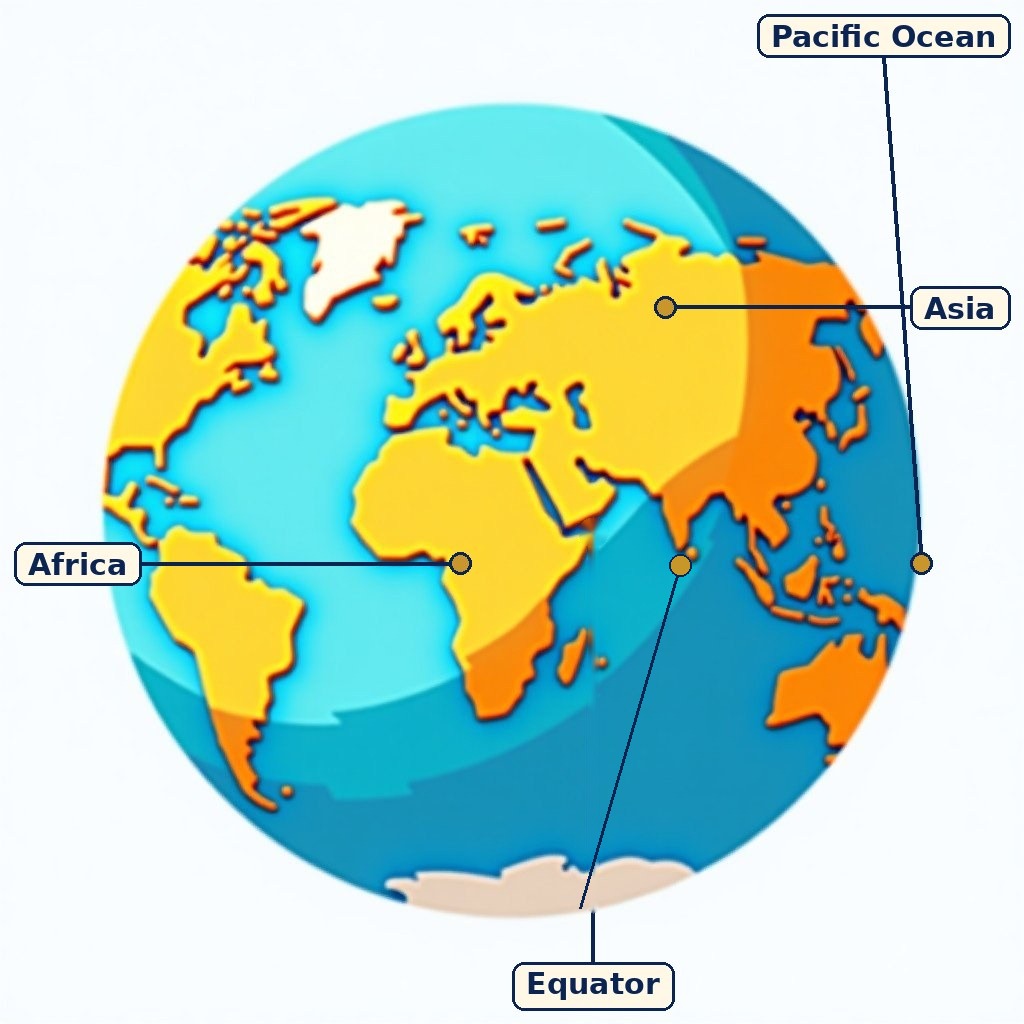
Diagram (labels are printed on the image): A globe showing continents and oceans. A general picture for learning world geography, not drawn to scale.
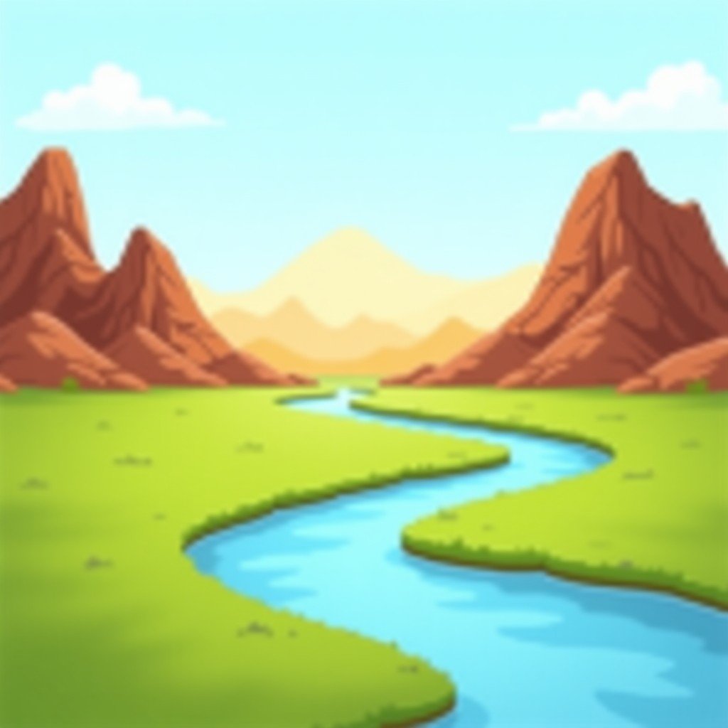
Mountains, deserts, rivers and plains — the Earth holds many kinds of landscapes.
What the chapter is about
Why study world geography
The Earth has long been revered as a mother — personified in India as Bhudevi or Vasudha — and human lives are deeply connected to its features. Studying world geography helps us understand landforms and water bodies, how they shape climate, ecosystems and human activities such as settlement, agriculture and trade, and why we must manage them wisely for sustainable development.
A round Earth on a flat map
Because the Earth is a sphere, any flat map must distort something — size, shape, distance or direction. That is why all map projections have some distortion, the chapter's first question. The Mercator projection preserves shape (useful for navigation) but exaggerates sizes near the poles; the Robinson projection is a compromise that balances size and shape but is exact in neither. Map colours also carry meaning: blue for water bodies, green for plains, yellow-brown for plateaus, dark brown for high mountains and light yellow for deserts.
The continents: variety on land
The most common count is seven continents — Africa, Asia, Europe, North America, South America, Australia (Oceania) and Antarctica. Each holds distinctive landscapes. A plateau is a landform that rises from its surroundings with a flat top: the Tibetan Plateau, called the 'Roof of the World', is the highest and largest, while the Colorado Plateau in North America shows deep river-carved landscapes. Deserts are large, extremely dry areas with low rainfall: the Gobi Desert lies in the 'Land of the Eternal Blue Sky' (Mongolia), and the Atacama Desert is famous for stargazing under some of the clearest skies on Earth.
Rainforests and oceans
The Amazon Rainforest is often called the 'Lungs of the Earth' because its vast forests produce oxygen and store carbon, though the chapter also asks you to think about why that nickname is only partly accurate. Coral reefs are called the 'rainforests of the sea' because, like rainforests, they shelter an extraordinary variety of life in a small area; the Great Barrier Reef faces threats today, above all from warming seas and coral bleaching. Oceans give us almost half the oxygen we breathe, through tiny plankton, and they regulate climate by storing heat and moving it through currents — which is why the chapter asks how the Indian and Pacific Oceans influence both climate and trade. The Suez Canal, a human-made passage opened in 1869 connecting the Red Sea with the Mediterranean, shows how a single waterway can reshape trade between the Indian Ocean and Europe.
How landforms shape life — and how people disturb the balance
Landforms are shaped by natural processes like tectonic movements, erosion and deposition, and in turn they influence climate, ecosystems and human life: where people settle, what they grow, and what they trade. Human actions disturb this balance — deforestation, overuse of resources and pollution cause desertification, biodiversity loss and climate change. The chapter's satellite pictures (from 1987 and 2021) let you see change over time in a landscape, and its final activities ask you to advise a government on protecting one major landscape, or to pitch a road trip across two continents using a blank map — geography as a skill you use, not only facts you memorise.
What you should learn
The Earth's surface holds varied landforms and water bodies shaped by tectonic movement, erosion and deposition; they shape climate, ecosystems and human life; every flat map distorts the round Earth; and human actions now threaten that balance, so geography must guide sustainable choices.
Key Terms
- Map projection — A method of showing the round Earth on a flat map; every projection distorts size, shape, distance or direction somewhere.
- Mercator projection — A projection that preserves shape (good for navigation) but exaggerates size near the poles.
- Robinson projection — A compromise projection that balances size and shape without being exact in either.
- Plateau — A landform that rises from its surroundings with a broad, fairly flat top — e.g. the Tibetan Plateau.
- Desert — A large, extremely dry area with very low rainfall — e.g. the Gobi and Atacama deserts.
- Coral reef — A marine structure built by tiny coral animals, sheltering huge biodiversity — called the 'rainforests of the sea'.
- Desertification — The process by which fertile land degrades into desert, often through deforestation, overuse and climate change.
Remember
- Seven continents is the most common count.
- Every map projection distorts something — Mercator keeps shape, Robinson compromises.
- Tibetan Plateau = 'Roof of the World'; Amazon = 'Lungs of the Earth'; reefs = 'rainforests of the sea'.
- Oceans give almost half our oxygen (plankton) and regulate climate through heat and currents.
- Suez Canal opened 1869: Red Sea to Mediterranean, Indian Ocean to Europe.
- Deforestation, overuse and pollution → desertification, biodiversity loss, climate change.
Exam Tip / Common Mistake
Common mistake: saying a map is 'wrong' because Greenland looks huge on a Mercator map. It is not wrong — it is a trade-off. In answers, always name what the projection preserves and what it distorts.
Blue = water; green = plains; yellow-brown = plateaus; dark brown = high mountains; light yellow = deserts. If a map question asks you to identify a feature, start from its colour and height, then its name.
'Lungs of the Earth' (Amazon) and 'rainforests of the sea' (reefs) are nicknames, not scientific definitions. A strong answer explains why the nickname arose — oxygen and carbon storage for the Amazon, biodiversity for reefs — and where it oversimplifies.
Chart / Table: Landscapes of the world — at a glance
| Point | Detail |
|---|---|
| Plateaus | Flat-topped highlands — Tibetan Plateau ('Roof of the World'), Colorado Plateau. |
| Deserts | Very dry lands — Gobi ('Land of the Eternal Blue Sky'), Atacama (famous for stargazing). |
| Rainforests | Dense, wet forests — Amazon ('Lungs of the Earth'); shelter huge biodiversity. |
| Coral reefs | 'Rainforests of the sea' — Great Barrier Reef threatened mainly by warming and bleaching. |
| Oceans | Regulate climate, give almost half our oxygen (plankton), carry world trade; Suez Canal (1869) links Indian Ocean and Europe. |
| Map projections | Mercator: shape true, size distorted. Robinson: compromise between size and shape. |
Practice set — try it yourself
- Why do all map projections have some amount of distortion?
Hint: Think about flattening a sphere — something must stretch or shrink. - What makes the Tibetan Plateau unique?
Hint: Think about height, size and its nickname. - Why are coral reefs called the 'rainforests of the sea'?
Hint: Think about biodiversity in a small area. - How do the oceans help to regulate the Earth's climate?
Hint: Think about heat storage and currents. - Choose one environmental issue (deforestation, reef bleaching or desertification) and outline causes, impacts and solutions.
Hint: Structure your answer in exactly those three parts.
Questions with Answers
- Why does every flat map distort the Earth?
Because the Earth is a sphere, and flattening a sphere must stretch or shrink some part of it. Every projection therefore trades off size, shape, distance or direction — Mercator preserves shape but exaggerates polar sizes, while Robinson compromises between size and shape. - What are the seven continents, and what variety do they hold?
Africa, Asia, Europe, North America, South America, Australia (Oceania) and Antarctica. They hold mountains, plateaus, plains, deserts, grasslands, rivers and oceans, shaped by tectonic movements, erosion and deposition. - Why is the Amazon called the 'Lungs of the Earth', and why are reefs the 'rainforests of the sea'?
The Amazon's vast forests produce oxygen and store carbon, like lungs for the planet. Coral reefs, like rainforests, shelter an extraordinary variety of life in a relatively small area — which is also why their loss matters so much. - How do oceans influence climate and trade?
Oceans store and move heat through currents, regulating climate, and their plankton produce almost half the oxygen we breathe. For trade, oceans carry most world goods, and passages like the Suez Canal (opened 1869, Red Sea to Mediterranean) shorten routes between the Indian Ocean and Europe. - How do human actions disturb the Earth's balance?
Deforestation, overuse of resources and pollution break natural cycles, causing desertification, biodiversity loss and climate change — the chapter's message is that studying geography should lead to managing landscapes wisely and sustainably.
Extension Questions with Answers
- Map question: on a blank world map, mark the Tibetan Plateau, the Gobi Desert, the Atacama Desert, the Amazon Rainforest and the Great Barrier Reef, and add the Suez Canal route.
Tibetan Plateau — Central Asia; Gobi — Mongolia/northern China; Atacama — western South America (Chile); Amazon — northern South America; Great Barrier Reef — off north-eastern Australia; Suez Canal — Egypt, Red Sea to Mediterranean. Rough positions with correct continents score; exact coordinates are not required. - Case-based: satellite pictures of one landscape from 1987 and 2021 look very different. What might have changed, and how would you investigate?
Possible changes: forest loss, urban growth, desert expansion, water shrinkage. Investigate by comparing land cover, checking rainfall and population data, and asking local people — the chapter's satellite-image activity tests exactly this reasoning. - What is the main reason the Great Barrier Reef faces threats today?
Warming seas causing coral bleaching, worsened by pollution and overuse. Bleaching means corals expel the algae that feed them, so the reef starves — the 'rainforest of the sea' loses its life. - Assertion–Reason: Assertion — The Mercator projection is the best map. Reason — It preserves shape. Judge both and the link.
The reason is true but the assertion is false as a general claim: 'best' depends on purpose — Mercator suits navigation, while a Robinson or equal-area map suits comparing country sizes. Purpose decides the projection. - How do two different geographical features influence life in their areas — and the whole globe?
Example: the Tibetan Plateau shapes Asia's great rivers and climate, affecting billions downstream; the Amazon shapes global carbon and rainfall far beyond South America. The chapter's exercise asks for exactly two such features, each with local and global effects. - Task — geographer's advice: choose one major landscape in your country and advise a government on protecting it.
Name the landscape, its threats (from the chapter's list: deforestation, pollution, overuse, climate change) and three concrete protections. This is a judgement task — marks come from reasoning, not from one 'correct' landscape. - How does the Atacama Desert's stargazing fame connect to its geography?
Extremely low rainfall means clear, dry air with little cloud — ideal for telescopes. Climate (dryness) thus creates a human activity (astronomy and tourism) that would be impossible in a cloudy, wet place. - Why does the chapter say studying geography helps sustainable development?
Because understanding how landforms, climate and ecosystems connect lets us predict the effects of our actions — where to build, farm, protect or restore — instead of damaging systems we do not understand.
- Round Earth → every flat map distorts; Mercator = shape, Robinson = compromise.
- Seven continents; plateaus, deserts, rainforests, reefs, oceans.
- Tibetan Plateau, Gobi, Atacama, Amazon, Great Barrier Reef, Suez Canal (1869).
- Oceans: almost half our oxygen, climate regulation, world trade.
- Human actions → desertification, biodiversity loss, climate change.
Going deeper — Chapter 8: World Geography: Some Glimpses
At the centre of this chapter are a few ideas that everything else hangs on: Map projection, Mercator projection, Robinson projection, Plateau. If you can explain those ideas in your own words without looking at the notes, you already hold the chapter's spine. Everything else on this page — the examples, the tables and the questions — is there to help you practise using those ideas, not to be memorised as separate facts.
Read the chapter in this order. First, read the summary slowly and ask yourself what question the chapter is answering. Then work through each section one at a time and, after each one, close the page and say its main point in two lines. The sections of this chapter are: What the chapter is about; Why study world geography; A round Earth on a flat map; The continents: variety on land; Rainforests and oceans; How landforms shape life — and how people disturb the balance. Each section adds one layer: an earlier section gives you the words and tools, and a later section shows you where those tools are used. When you revise, do not re-read passively — explain each section aloud as if you were teaching a classmate who missed the lesson.
In social science answers, build a chain: cause, event, consequence, conclusion. Use subject terms exactly, give dates and places only when you are sure of them, and end with a one-line conclusion that answers the question directly instead of trailing off.
Important Questions with Answers — deepening set
These questions go beyond the sets above. Try each one without looking, then check your answer against the notes.
- What does 'Map projection' mean? Explain it in your own words and say how it is used in this chapter.
A method of showing the round Earth on a flat map; every projection distorts size, shape, distance or direction somewhere. In this chapter, Map projection is one of the ideas you must be able to use, not just define. When a question mentions Map projection, first write its meaning in one line, then apply it to the situation in the question. That two-step habit — meaning first, application second — is what turns a definition into marks. - What does 'Mercator projection' mean? Explain it in your own words and say how it is used in this chapter.
A projection that preserves shape (good for navigation) but exaggerates size near the poles. In this chapter, Mercator projection is one of the ideas you must be able to use, not just define. When a question mentions Mercator projection, first write its meaning in one line, then apply it to the situation in the question. That two-step habit — meaning first, application second — is what turns a definition into marks. - What does 'Robinson projection' mean? Explain it in your own words and say how it is used in this chapter.
A compromise projection that balances size and shape without being exact in either. In this chapter, Robinson projection is one of the ideas you must be able to use, not just define. When a question mentions Robinson projection, first write its meaning in one line, then apply it to the situation in the question. That two-step habit — meaning first, application second — is what turns a definition into marks. - What does 'Plateau' mean? Explain it in your own words and say how it is used in this chapter.
A landform that rises from its surroundings with a broad, fairly flat top — e.g. the Tibetan Plateau. In this chapter, Plateau is one of the ideas you must be able to use, not just define. When a question mentions Plateau, first write its meaning in one line, then apply it to the situation in the question. That two-step habit — meaning first, application second — is what turns a definition into marks. - What does 'Desert' mean? Explain it in your own words and say how it is used in this chapter.
A large, extremely dry area with very low rainfall — e.g. the Gobi and Atacama deserts. In this chapter, Desert is one of the ideas you must be able to use, not just define. When a question mentions Desert, first write its meaning in one line, then apply it to the situation in the question. That two-step habit — meaning first, application second — is what turns a definition into marks. - What does 'Coral reef' mean? Explain it in your own words and say how it is used in this chapter.
A marine structure built by tiny coral animals, sheltering huge biodiversity — called the 'rainforests of the sea'. In this chapter, Coral reef is one of the ideas you must be able to use, not just define. When a question mentions Coral reef, first write its meaning in one line, then apply it to the situation in the question. That two-step habit — meaning first, application second — is what turns a definition into marks.
Revision checklist and exam writing guide
Use this checklist the night before a test. Tick a point only if you can do it without opening the notes.
- I can explain 'What the chapter is about' in two lines without looking.
- I can explain 'Why study world geography' in two lines without looking.
- I can explain 'A round Earth on a flat map' in two lines without looking.
- I can explain 'The continents: variety on land' in two lines without looking.
- I can explain 'Rainforests and oceans' in two lines without looking.
- I can explain 'How landforms shape life — and how people disturb the balance' in two lines without looking.
- I can write the chapter's key terms from memory, with one example for each.
- I can answer one long question from this chapter in five ordered paragraphs.
In social science answers, build a chain: cause, event, consequence, conclusion. Use subject terms exactly, give dates and places only when you are sure of them, and end with a one-line conclusion that answers the question directly instead of trailing off.
Common mistake to avoid: writing everything you remember about the chapter instead of answering the question asked. Read the question twice, underline its command word — explain, compare, why, what happens — and let that word decide the shape of your answer.
How to use this page: Read the summary, say the Key Terms in your own words, then try the practice set without looking. Use the Questions with Answers to check yourself afterwards. Ask your teacher or parent to check your answers.